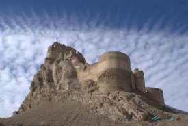
In the rugged landscape of Syunik Province, where the mountains seem to close in on the deep valleys, stands the fortress of Baghaberd. This defensive complex is not merely a stone ruin; it is the symbol of a kingdom’s last stand and a silent witness to one of the greatest cultural tragedies in Armenian history. Located about 14 kilometers northwest of the city of Kapan, Baghaberd took advantage of the hostile geography of the Caucasus to become a refuge that, for centuries, was considered impregnable.
The history of Baghaberd is intertwined with the chronicles of ancient Armenia. Although some legends attribute its founding to mythical figures from Armenian genealogy, the most reliable historical records trace its significance back to the 4th century AD. At that time, the fortress served as a vital checkpoint on the route connecting the highlands with the river valleys.