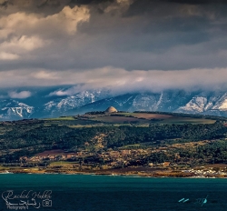
Southwest of Tiaret, the Djeddars stand apart from the familiar images of Roman North Africa. Their stepped stone masses are funerary monuments on exposed hills, arranged in two groups rather than gathered in one walled archaeological town. Algeria's 2025 submission to UNESCO's World Heritage tentative list describes thirteen mausolea around Tousnina and Medghoussa, near Frenda. Three occupy Jebel Lakhdar and ten Jebel Arroui, according to Algerian archaeological research. Seen together, they form a burial landscape looking across the Sersou plain. Their setting is part of their meaning: the monuments were placed where they could command a wide horizon.
A visitor searching for a neat list of kings will be disappointed. The tombs are often called royal mausolea, but the identities of those buried inside are not securely established in the sources consulted here. UNESCO's tentative description associates them with late antique communities of the region and dates them broadly to the fifth and sixth centuries, while scholarly work explores different construction sequences. That uncertainty is the story, not a defect to be hidden. These structures belong to an era when political power, local traditions and forms inherited from the Roman world crossed paths in the Maghreb.