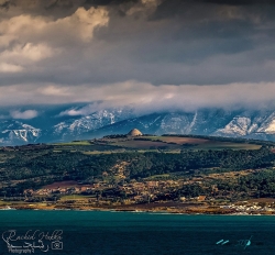
The Corniche du Chenoua follows the Mediterranean coast west of Tipasa toward Cherchell, where Mount Chenoua drops into a sequence of cliffs, headlands and small beaches. Algeria’s Ministry of Environment describes the mountain as the highest point in the western Algiers Sahel hills, reaching 905 meters, bounded broadly by the Nador River near Tipasa and the Hachem River toward Cherchell.
This is a scenic corridor rather than one gated attraction. The road offers changing views of sea and mountain, while individual beaches, caves and pull-offs have their own access and safety conditions. “Corniche Chenoua” may label a broad section on maps, so travelers should identify a lawful stop before setting out and avoid halting on blind bends for photographs.