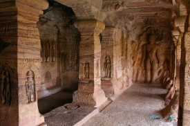
Hampi spreads across a spectacular landscape of rounded granite boulders and the Tungabhadra River in Karnataka. More than 1,600 recorded remains—temples, markets, gateways, waterworks, royal buildings and defensive lines—survive from the capital of the Vijayanagara Empire and from earlier settlement. The scale defeats rushed sightseeing. Hampi is best understood as a planned metropolitan landscape whose sacred, commercial and courtly zones were connected to farms, reservoirs and routes through the hills.
Vijayanagara was founded in the fourteenth century and reached a celebrated peak under Krishnadevaraya, who ruled from 1509 to 1529. Foreign visitors described a wealthy trading city. After the allied Deccan sultanates defeated Vijayanagara forces at Talikota in 1565, the capital was plundered and its political role collapsed. “Abandoned,” however, is incomplete: Virupaksha Temple remained an active pilgrimage centre, and communities, agriculture and worship continue throughout the World Heritage landscape.