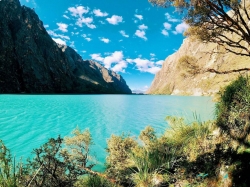
High above Cajamarca, Cumbemayo combines eroded volcanic formations with an ancient channel cut through rock. Towers and narrow passages in the “stone forest” have acquired popular names based on imagined shapes, but the site’s archaeological importance lies in how pre-Hispanic communities marked, channelled and understood this high Andean environment. At roughly 3,500 metres, weather and altitude shape every visit.
The best-known feature is a carefully worked aqueduct or canal whose angular turns and carved sections direct water across the watershed. It is often dated broadly to the first millennium BC and associated with the wider formative-period cultures of northern Peru. Exact dates, builders and functions remain debated. Claims that every zigzag encoded astronomy or that the channel moved water “against gravity” are not supported; the engineering follows a controlled gradient.