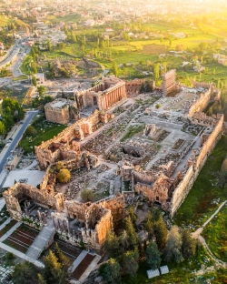
The Citadel of Damascus holds the northwestern corner of the old city, near the Barada River. Its massive outline belongs to the urban fabric rather than to a remote landscape: the fortress is part of the way historic Damascus meets the surrounding streets. Towers, walls and entrances carry a military presence, but the story inside them also concerns administration, residence and the changing uses of a powerful place at the centre of a city.
The citadel forms part of the Ancient City of Damascus, inscribed on the World Heritage List in 1979. It is not a separate UNESCO property with an independent inscription date. That relationship matters because the fortress cannot be understood without its setting. A defensive enclosure, neighbouring markets and the wider inhabited city belong to connected histories, even when a photograph isolates the walls and makes them appear to stand outside everyday urban life.