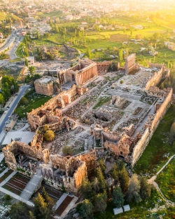
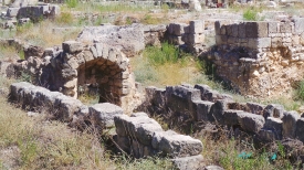
Anjar is one of the most revealing surviving urban projects of the early Islamic world. Founded in the early eighth century under the Umayyad caliph al-Walid I, the city was laid out at a strategic crossroads in Lebanon’s Bekaa Valley, where routes linked Beirut with Damascus and the north with Palestine. Unlike a settlement that accumulated irregularly over centuries, Anjar presents a deliberate rectangular plan whose streets, palaces, mosque, baths and shops can still be read on the ground.
UNESCO inscribed Anjar in 1984 as a unique testimony to Umayyad town planning. Archaeological excavation began only in the late 1940s and revealed a fortified enclosure measuring approximately 385 by 350 metres, strengthened by about 40 towers. Two colonnaded avenues meet near a monumental tetrapylon and divide the city into four quarters. Drainage channels beneath the main streets show that infrastructure was designed together with ceremonial architecture.