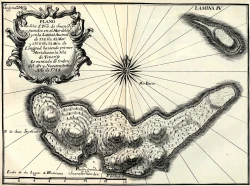
Cayo Santa María, Cuba: beaches, causeway and the Buenavista coast
An island on Cuba’s northern coast
Cayo Santa María lies off the north-central coast of Cuba, in Villa Clara Province, and forms part of the Jardines del Rey chain of keys. The name is also used for the wider resort destination that links Santa María with neighboring cays, especially Las Brujas and Ensenachos. Cuba Travel describes Santa María as the largest and northernmost of the keys along the road over Buenavista Bay. For visitors, the distinction matters: an itinerary advertised as Cayo Santa María may include services or excursions based on another island in the connected group.
The approach is an unusual part of the trip. A 48-kilometre causeway, known locally as a pedraplén, crosses the sea from the mainland near Caibarién to Cayo Santa María. Cuba Travel’s hotel information describes the road as the link between the mainland and the island; the provincial tourism office also identifies Cayo Las Brujas airport as an air connection for the Cayo Santa María tourism area. The causeway makes a road journey possible, but it does not mean the island is close to every Cuban city or that all transport runs on a fixed visitor schedule.
Beaches across a chain of keys
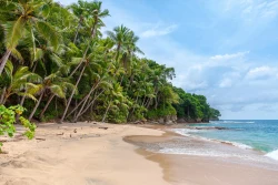
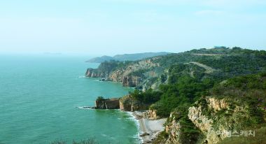
Cuba Travel names Perla Blanca, Las Caletas, Cañón and Cuatro Puntas among the beaches on Cayo Santa María. The official provincial page presents them as a sequence of coastal settings, with low cliffs and open sea contributing to the scenery. Rather than treating the island as one continuous resort beach, visitors can use those names to understand the coastline and ask their accommodation or local operator which areas are accessible during their stay.
The neighboring keys have distinct landscapes of their own. Cuba Travel describes Las Brujas as a key with a roughly two-kilometre beach and a nearby coral barrier, while Ensenachos is smaller and has beaches called Ensenachos and El Mégano. The cays are connected by the road network, so a marine excursion or day trip may take visitors beyond the specific island named in a hotel reservation. Confirm departure points and transport before booking; facilities, routes and access permissions can differ from one cay to another.
A marine landscape with conservation value
The waters and islands belong to an ecologically sensitive part of Cuba’s north coast. UNESCO’s Buenavista Biosphere Reserve profile places the reserve across parts of Villa Clara, Sancti Spíritus and Ciego de Ávila provinces. It describes a larger marine zone with coral reefs and rocky and sandy beaches, and a land environment that includes mangroves and coastal forest. The reserve was nominated in 2000 and includes Santa María Key National Park among its core protected areas.
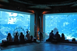
Cuba Travel says the seabed around Cayo Santa María has 24 dive sites and points to guided diving and catamaran outings offered through the local marina and dive centre. These descriptions show why the destination appeals to people interested in reefs as well as beach time, but they should not be read as a guarantee that every trip is operating on a particular date. Ask the operator about current departures, certification requirements, sea conditions and conservation rules. In a sensitive coastal environment, responsible boating, careful snorkeling and following guide instructions help reduce disturbance to marine habitats.
Getting there and arranging your stay
Villa Clara’s official tourism information identifies Abel Santamaría International Airport outside Santa Clara and the smaller Cayo Las Brujas airport on the keys. The provincial page describes the latter as an air link for the Cayo Santa María tourism area. It also lists road transport options in Villa Clara, including buses, taxis and car rental, though routes and services can change. Check flight schedules and ground transfers with airlines, accommodation providers or the relevant transport company instead of relying on a directory listing alone.
Most accommodation is marketed as part of a resort destination, and official tourism pages list hotels and excursion services in the area. However, online listings do not confirm which properties, restaurants or activities are currently taking bookings. Verify the operating status, what is included in the rate, transfer arrangements and any requirements directly before paying. The long causeway means that an apparently nearby town or service may still involve a substantial drive; plan food, transfers and arrival times accordingly, especially if arriving after dark.
How to make the most of Cayo Santa María
A balanced visit can combine beach time with a closer look at the geography that makes the destination distinctive. Spend time understanding the chain of keys, the route across Buenavista Bay and the protected habitats described by UNESCO. If you book diving or a boat trip, confirm the destination, duration and meeting point, and follow the crew’s instructions around reefs and wildlife. For a quieter day, choose a beach based on current access and sea conditions rather than assuming every shoreline has the same facilities.
Cayo Santa María is appealing not only for pale sand and clear tropical water but also for its unusual connection to the Cuban mainland and its place within a wider biosphere reserve. The journey across the causeway, the neighboring keys and the marine environment all form part of the experience. Because transport, accommodation and excursion details are operational and can change, check them shortly before travel. That small step leaves more time to enjoy the coast while treating its sensitive landscape with the care it deserves.