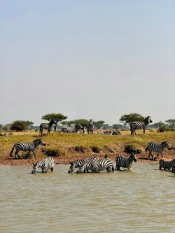
The Ngorongoro Conservation Area lies in northern Tanzania’s Crater Highlands, west of Arusha. It covers about 809,440 hectares of highland plains, savanna, woodland and forest. The famous Ngorongoro Crater is its best-known feature, but the protected area also includes archaeological landscapes, other volcanic formations and pastoral communities. Planning only for a crater drive misses the scale and the multiple purposes of a place managed for wildlife, heritage and human use.
Tanzania established the conservation area in 1959 as a multiple-use landscape where wildlife and semi-nomadic Maasai pastoralists could coexist. UNESCO first inscribed it as a natural World Heritage property in 1979 and added cultural value in 2010. The area is therefore recognized for ecological processes and scenery as well as evidence of human evolution and long relationships between people and environment. That mixed status makes the conservation area different from a national park whose visitor story is framed only around wildlife.