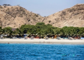
In northwestern Peru, the Cerros de Amotape National Park protects a landscape that changes dramatically across a short distance. Most of its rugged hills are covered by Equatorial dry forest; in the northeastern sector, wetter Pacific tropical forest appears. The Tumbes River cuts through much of the protected area, helping create this ecological transition near the border with Ecuador. It is a conservation landscape first, not a developed resort or an easy roadside attraction.
SERNANP, Peru’s protected-areas authority, says the park was created on 22 July 1975 to protect northwestern dry forests threatened by logging for timber, fuelwood and charcoal. It spans parts of Tumbes and Piura, including the provinces of Tumbes, Zarumilla and Contralmirante Villar, as well as Sullana. Official sources publish differing area figures, so this article avoids presenting one as definitive; the park’s boundaries and ecological importance are the more useful facts for visitors.