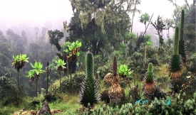
Bwindi Impenetrable National Park lies in southwestern Uganda, close to the borders with the Democratic Republic of the Congo and Rwanda. Its steep, densely wooded slopes form part of the Albertine Rift, a region where elevation, rainfall and long periods of ecological isolation have produced exceptional biological diversity. The national park covers about 321 square kilometres; UNESCO’s listed property is measured at 32,092 hectares, a closely corresponding figure expressed in hectares.
“Impenetrable” is not just a dramatic name. The forest is old, thick and cut by deep valleys, while trails climb and descend through wet ground, roots and tangled vegetation. The park rises from roughly 1,160 to 2,607 metres above sea level. A visit therefore feels less like a walk through a landscaped attraction than an entry into a living forest, where visibility, pace and comfort can change from one slope to the next.