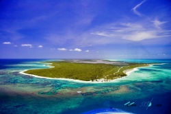
Brimstone Hill Fortress occupies a steep volcanic ridge above the western coast of St Kitts, where the view reaches across the Caribbean toward neighboring islands. The setting explains the military logic: from this elevated position, British forces could watch approaches by sea and defend a valuable colonial possession. Today the same height that made the site strategic makes the walk memorable, but it also means visitors should expect slopes, stone steps and exposed sun.
The fortress is not a single building. Its bastions, barracks, cisterns, retaining walls and roads form a layered system spread across the upper slopes of a twin-peaked hill. Fort George, also called the Citadel, dominates one summit. UNESCO identifies the site as an exceptionally preserved example of seventeenth- and eighteenth-century British military engineering adapted to a Caribbean landscape, rather than a European fort simply copied overseas.