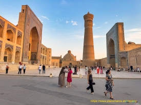
On the western edge of Bukhara’s historic centre, the Ark rises above the surrounding streets as a compact, walled world of gates, courtyards and museum rooms. It was not simply a defensive fort. For centuries it housed rulers and the institutions that supported government: residences, offices, workshops, treasury and arsenal. The museum-reserve describes it as the seat of Bukhara’s rulers until 1920, when political upheaval destroyed much of the eastern side. What survives is both a monument and an archaeological landscape.
The scale is easier to appreciate from outside. The museum gives the enclosure an area of about 3.9 hectares and says its walls extend for 789 metres, rising roughly 16 to 20 metres above the ground. The citadel stands on a mound about six metres high. From the pavement, those dimensions explain why the Ark dominates the approach; from inside, however, its courtyards reveal a working compound rather than one single palace building.