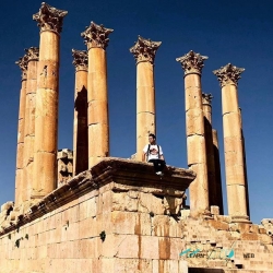
Jabal al-Qal’a, usually called the Amman Citadel in English, rises above downtown on a natural hill that the Jordanian Department of Antiquities describes at roughly 840 metres above sea level. Valleys surround much of the summit, leaving a high point with commanding views across the modern capital. The setting is more than a scenic overlook: it helps explain why communities repeatedly built, occupied and reshaped this ground.
Archaeological evidence on the hill records occupation across a long sequence, from the Bronze and Iron Ages through Hellenistic, Roman, Byzantine and Islamic periods. It is therefore misleading to treat the Citadel as one building or one civilization’s monument. The visible structures belong to different chapters, and excavations have also revealed places whose use is not immediately obvious to a first-time visitor.